✓ Vancouver boasts an extensive and efficient public transit network.
✓ The city is highly walkable and bike-friendly, with dedicated infrastructure.
✓ Compass Card is essential for seamless public transit use.
✓ Many key attractions are centrally located and easily accessible without a car.
How It Works
1
Acquire a Compass Card
Purchase a reloadable Compass Card from SkyTrain stations, London Drugs, or authorized vendors. Load it with stored value or a day pass for convenient travel.
2
Plan Your Routes with Apps
Utilize transit apps like TransLink's official app, Google Maps, or Citymapper to plan your journeys. These provide real-time updates and multiple transport options.
3
Embrace Multi-Modal Transport
Combine SkyTrain, buses, SeaBus, walking, and cycling to efficiently navigate different areas. Vancouver's infrastructure supports seamless transitions between modes.
4
Explore Local Neighborhoods
Once you arrive at a neighborhood via transit, explore on foot or rent a bike. This allows for deeper immersion and discovery of hidden gems.
Mastering Vancouver's Public Transit System
Photo: Glen Zi 加侖子 / Pexels
Navigating a new city can often feel daunting, especially when you're committed to exploring without the convenience of a personal vehicle. However, Vancouver stands out as a shining example of a metropolitan area designed for car-free exploration. Its public transit system, operated by TransLink, is incredibly comprehensive, efficient, and user-friendly, making it the backbone of any car-free adventure here. Understanding how to leverage this network is your first and most important step to truly experiencing Vancouver like a local.
The core of Vancouver's public transit is its integrated system, comprising the SkyTrain (an automated rapid transit system), an extensive bus network, and the SeaBus (a passenger ferry connecting downtown Vancouver with North Vancouver). The SkyTrain is particularly impressive, with three main lines: the Expo Line, Millennium Line, and Canada Line. The Expo Line connects downtown with Burnaby, New Westminster, and Surrey. The Millennium Line loops through Burnaby and Port Moody, intersecting with the Expo Line at several points. The Canada Line is arguably the most useful for visitors, directly linking Vancouver International Airport (YVR) and Richmond with downtown Vancouver in under 30 minutes, making airport transfers incredibly simple and cost-effective. These lines are not just for commuters; they are your direct access to major attractions like Granville Island (via Olympic Village Station), Gastown (Waterfront Station), and Stanley Park (Burrard Station, followed by a short walk or bus ride).
Buses fill in the gaps where SkyTrain doesn't reach, serving every corner of the city and its surrounding municipalities. They are frequent, clean, and equipped with bike racks, which is a huge bonus for cyclists. For example, to get to the beaches of Kitsilano or Jericho, a bus ride from downtown is your best bet. The SeaBus, a 12-minute scenic ferry ride across Burrard Inlet, offers stunning city views and connects Waterfront Station in downtown Vancouver to Lonsdale Quay in North Vancouver. From Lonsdale Quay, you can easily catch buses to popular North Shore attractions like Grouse Mountain or the Capilano Suspension Bridge Park. The beauty of TransLink is its seamless integration: a single Compass Card allows you to transfer between SkyTrain, bus, and SeaBus within a 90-minute window, making multi-modal journeys incredibly efficient.
To maximize your public transit experience, investing in a Compass Card is highly recommended. This reloadable smart card eliminates the need for exact change on buses and offers discounted fares compared to single-use tickets. You can purchase a Compass Card from SkyTrain stations, London Drugs, and various other retailers, then load it with stored value or a day pass. For longer stays, a monthly pass might be more economical. Utilizing apps like TransLink's official app, Google Maps, or Citymapper will be invaluable for real-time schedule updates, route planning, and identifying the quickest way to your destination. These tools are indispensable for navigating the city without a car and ensure you spend less time waiting and more time exploring Vancouver's wonders. Discover more about efficient urban travel strategies to enhance your Vancouver experience.
Embracing Vancouver's Walkability and Cycling Culture
Photo: Caio / Pexels
Beyond its excellent public transit, Vancouver truly shines as a city designed for pedestrians and cyclists. Its relatively flat downtown core, combined with stunning waterfront promenades and dedicated bike lanes, makes exploring on foot or by bike not just feasible, but often the most enjoyable and immersive way to experience the city. You’ll find that many of Vancouver’s most iconic attractions are clustered together, allowing for easy, scenic walks between them, offering a perspective you simply can’t get from inside a car or bus.
The city's walkability is legendary, with many neighborhoods boasting a Walk Score of 90 or higher. Downtown Vancouver, Gastown, Yaletown, and the West End are prime examples where you can spend entire days exploring on foot. Imagine strolling through the historic cobblestone streets of Gastown, admiring its Victorian architecture and steam clock, then making your way along the vibrant seawall towards Canada Place, with its iconic sails. From there, a pleasant walk can take you into the heart of the shopping district on Robson Street, or south towards the entertainment hub around Granville Street. The Vancouver Seawall, a continuous paved pathway stretching over 28 kilometers, is a highlight. It circles Stanley Park, connects False Creek, and extends to Kitsilano Beach, offering breathtaking views of the city skyline, mountains, and ocean. Walking a section of the seawall, especially around Stanley Park, is an essential Vancouver experience and completely free.
For those who prefer a faster pace, Vancouver's cycling culture is robust and well-supported. The city has invested heavily in creating an extensive network of separated bike lanes and multi-use paths, making it safe and enjoyable to cycle almost anywhere. Bike share programs, such as Mobi by Shaw Go, are readily available throughout the downtown core and surrounding neighborhoods. These offer a convenient way to pick up a bike for a short ride and drop it off at another station when you're done. Rental shops also abound, especially near popular cycling areas like Stanley Park and the False Creek Seawall, offering everything from basic cruisers to electric bikes. Cycling the Stanley Park Seawall is a quintessential Vancouver activity, offering unparalleled views and a fantastic workout. You can rent a bike near Denman Street and embark on the 10-kilometer loop, stopping at viewpoints like Siwash Rock or the Lions Gate Bridge.
Combining walking and cycling with public transit creates a powerful multi-modal strategy. For instance, you might take the SkyTrain to a specific neighborhood, then rent a bike to explore its parks and waterfront, or simply walk through its unique streets and discover local cafes and shops. This approach not only saves money on transportation but also allows for a more intimate connection with the city, enabling you to discover hidden gems and local favorites that might be missed from the window of a car. The ease of transitioning between these modes is a testament to Vancouver’s thoughtful urban planning, making it a dream destination for car-free travelers.
Strategic Planning for Car-Free Exploration of Vancouver Attractions
Photo: The Six / Pexels
Successfully navigating Vancouver without a car hinges significantly on strategic planning, especially when it comes to visiting its diverse array of attractions. While spontaneous exploration is part of the fun, having a rough itinerary that groups nearby attractions together can save you considerable time and effort. Vancouver’s layout, with its distinct neighborhoods, lends itself perfectly to this approach, allowing you to maximize your sightseeing while minimizing travel time between destinations. Understanding the geographical relationship between key sites and leveraging the city's transport options efficiently will transform your car-free trip into a seamless adventure.
Consider grouping attractions by geographical proximity. For example, a day dedicated to downtown Vancouver could include Gastown, Canada Place, the Vancouver Art Gallery, and Robson Street for shopping. All of these are within easy walking distance of each other and well-served by SkyTrain stations (Waterfront, Burrard, Vancouver City Centre). Another excellent cluster for a car-free day is the area around False Creek. You can take the AquaBus or False Creek Ferry from Granville Island to Science World, Olympic Village, or Yaletown, enjoying scenic water views along the way. Granville Island itself is a pedestrian paradise, and easily accessible by foot, bus, or the aforementioned ferries. These smaller ferries are not part of TransLink but are incredibly convenient and charming for short hops across the inlet.
When venturing further afield to attractions like the Capilano Suspension Bridge Park or Grouse Mountain, public transit remains your best friend. From downtown, you can take the SeaBus to Lonsdale Quay, and from there, connect to specific bus routes (e.g., #236 for Capilano Suspension Bridge, #232 for Grouse Mountain). Both attractions also offer shuttle services from various downtown locations, which can be a convenient option. Always check their official websites for the most up-to-date shuttle schedules and pick-up points. For a trip to the University of British Columbia (UBC) and its renowned Museum of Anthropology, numerous bus routes directly connect from downtown, such as the #4 or #14.
Another crucial aspect of car-free travel is embracing flexibility and being prepared for varying weather conditions. Vancouver is known for its rain, so an umbrella and waterproof jacket are essential, regardless of the season. Comfortable walking shoes are non-negotiable. Furthermore, consider purchasing attraction passes like the Vancouver City Pass if you plan to visit multiple paid attractions. While these passes don't cover transportation, they can offer significant savings on entry fees, leaving more of your budget for transit fares or bike rentals. By combining smart planning, an understanding of the transit network, and a willingness to walk or cycle, you'll discover that Vancouver is not just navigable without a car, but arguably best experienced that way, allowing for spontaneous discoveries and a deeper connection with the city's vibrant pulse. Explore more travel hacks for urban adventures to make your trip even smoother.
Essential Tips and Common Mistakes for Car-Free Vancouver Travel
Photo: Tejvinder Singh / Pexels
To truly master how to get around Vancouver without a car, it’s not just about knowing the options, but also about adopting smart strategies and avoiding common pitfalls. These tips will help you navigate like a seasoned local, ensuring your trip is as smooth and enjoyable as possible, free from transportation woes.
**Essential Tips for Success:**
* **Get a Compass Card immediately:** This is paramount. Not only does it offer cheaper fares than cash for buses (which require exact change), but it also allows for seamless transfers between all modes of TransLink services within 90 minutes. You can load it with stored value or opt for a DayPass if you plan extensive travel within a 24-hour period. Remember to tap on and off SkyTrain and SeaBus, but only tap on when boarding a bus.
* **Download Essential Apps:** Google Maps, TransLink's official app (for real-time schedules and disruptions), and Citymapper are invaluable. They provide accurate directions, estimated travel times, and even integrate bike-share options. Having these on your phone will save you countless minutes of waiting and confusion.
* **Embrace Walking Shoes:** Vancouver is incredibly walkable, especially its downtown core, Gastown, Yaletown, and the West End. Comfortable shoes are a must for exploring neighborhoods, strolling along the seawall, and getting to transit stops. You'll cover more ground and discover hidden gems.
* **Consider Bike Share or Rentals:** For scenic routes like the Stanley Park Seawall or exploring False Creek, a bicycle is ideal. Mobi by Shaw Go is convenient for short rides, while dedicated rental shops offer bikes for longer periods. Always wear a helmet – it’s the law in BC.
* **Utilize Water Ferries:** The False Creek Ferries and AquaBus are charming and efficient ways to cross False Creek, connecting Granville Island, Yaletown, Science World, and Olympic Village. They offer great views and bypass street traffic.
* **Understand Zone System (SkyTrain/SeaBus):** TransLink uses a zone system for SkyTrain and SeaBus fares during peak hours (weekdays until 6:30 PM). Off-peak, all travel is charged at a one-zone fare. Buses are always a one-zone fare, regardless of distance or time. Your Compass Card automatically calculates the fare.
**Common Mistakes to Avoid:**
* **Relying solely on taxis/ride-shares:** While available, these can quickly become expensive, especially during peak times or for longer distances. Use them sparingly, perhaps for late-night returns or when carrying heavy luggage.
* **Not checking operating hours:** Public transit doesn't run 24/7. SkyTrain and SeaBus services typically end around 1 AM on weekdays and later on weekends. Always check the last departure times if you plan a late night out.
* **Underestimating walking distances:** While many attractions are close, walking from, say, Gastown to Kitsilano Beach is a significant trek. Plan your routes, or combine walking with a bus or SkyTrain ride.
* **Ignoring the weather:** Vancouver weather can be unpredictable. Don't leave your accommodation without an umbrella or a waterproof layer, even if the sun is shining. A sudden downpour can quickly dampen your spirits if unprepared.
* **Forgetting to tap off:** On SkyTrain and SeaBus, you must tap your Compass Card both when entering and exiting the system to ensure you're charged the correct fare. Forgetting to tap off will result in being charged the maximum three-zone fare.
By keeping these tips in mind and avoiding these common errors, your car-free Vancouver adventure will be not only feasible but also incredibly rewarding, allowing you to fully immerse yourself in the city's unique charm and beauty.
Comparison
Feature
Public Transit
Walking
Cycling
Ride Share/Taxi
Cost
Low
Free
Low (rental/share)
High
Speed
Moderate to Fast
Slow
Moderate to Fast
Fast
Convenience
High
High (short distances)
High (with infrastructure)
High (on-demand)
Scenic Value
Moderate
High
Very High
Low
Flexibility
Moderate
High
High
Very High
Weather Dependent
Partially
Highly
Highly
Not much
Accessibility
✓
✗
✗
✓
Environmental Impact
Low
Very Low
Very Low
Moderate
What Readers Say
★★★★★
"Using the Compass Card and SkyTrain made getting around Vancouver without a car incredibly easy. We saved so much money and never felt lost, even going to the airport."
Emily R. · Seattle, WA
★★★★★
"We walked everywhere in Gastown and Yaletown, then hopped on a bus to Kitsilano Beach. Vancouver is truly designed for pedestrians, and the views from the seawall were stunning."
Ben T. · London, UK
★★★★★
"Renting bikes to cycle Stanley Park was the highlight of our trip! It was so easy to pick up and drop off, and the dedicated bike lanes made me feel very safe. Highly recommend going car-free."
Sophia L. · Toronto, ON
★★★★★
"Public transit was generally excellent, though a couple of bus routes had minor delays. Still, for the cost and coverage, it's definitely the best way to see Vancouver without a car."
David K. · Portland, OR
★★★★★
"From the airport straight to downtown via the Canada Line, then SeaBus to North Van for Grouse Mountain – all without a single car. Vancouver's transit system is a tourist's dream come true."
Chloe M. · Sydney, AUS
Frequently Asked Questions
Is Vancouver easy to navigate without a car?
Yes, Vancouver is exceptionally easy to navigate without a car. The city boasts an extensive, integrated public transit system (TransLink) including SkyTrain, buses, and SeaBus, complemented by high walkability and a robust cycling infrastructure. Many key attractions are centrally located and well-connected, making car-free exploration both convenient and enjoyable.
Do I need a Compass Card to use public transit in Vancouver?
While you can pay with cash on buses (exact change required), a Compass Card is highly recommended. It offers discounted fares, allows for seamless transfers between SkyTrain, bus, and SeaBus within a 90-minute window, and eliminates the need for exact change. You can purchase and load them at SkyTrain stations, London Drugs, and other retailers.
How do I get from Vancouver International Airport (YVR) to downtown without a car?
The Canada Line SkyTrain is the most efficient and cost-effective way to get from YVR to downtown Vancouver. The journey takes approximately 25-30 minutes and departs directly from the airport terminal. You will need a Compass Card or a single-use ticket, and an additional 'YVR AddFare' applies when departing from the airport.
Is it expensive to get around Vancouver using public transport?
Compared to driving and parking, using public transport in Vancouver is very cost-effective. A single adult fare typically ranges from $2.55 to $5.00 depending on zones and peak hours (Compass Card rates). DayPasses are also available for unlimited travel within a 24-hour period, offering excellent value for extensive sightseeing.
How does Vancouver's public transit compare to other major cities for car-free travel?
Vancouver's public transit system is highly regarded and compares favorably to many major cities globally. Its automated SkyTrain, comprehensive bus network, and integrated fare system make it efficient and user-friendly. Combined with the city's exceptional walkability and bike-friendly infrastructure, it stands out as one of the best North American cities for car-free travel.
Who should consider getting around Vancouver without a car?
Anyone visiting Vancouver, from solo travelers to families, should consider getting around without a car. It's ideal for those looking to save money on parking and rental fees, reduce their environmental footprint, enjoy scenic walks and bike rides, and experience the city's vibrant neighborhoods more intimately. It's particularly beneficial for tourists staying in the downtown core or near SkyTrain stations.
Is cycling safe in Vancouver?
Yes, cycling in Vancouver is generally very safe, especially within the downtown core and along major routes. The city has invested heavily in separated bike lanes and multi-use paths, creating a safe environment for cyclists. Helmets are mandatory by law in British Columbia, and bike rental shops always provide them. Always be aware of your surroundings and follow traffic laws.
Are there any future plans to improve car-free travel in Vancouver?
Yes, TransLink consistently invests in expanding and improving its network, with ongoing projects like the Broadway Subway Project (Millennium Line extension) set to enhance connectivity significantly. The city also continues to expand its cycling infrastructure and pedestrian-friendly initiatives, reinforcing its commitment to sustainable, car-free urban mobility in the future.
Embrace the freedom and convenience of car-free exploration, and discover how to get around Vancouver without a car with ease. From efficient public transit to scenic walks and exhilarating bike rides, your ultimate Vancouver adventure awaits. Start planning your sustainable and memorable trip today!

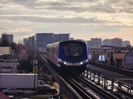 Photo: Glen Zi 加侖子 / Pexels
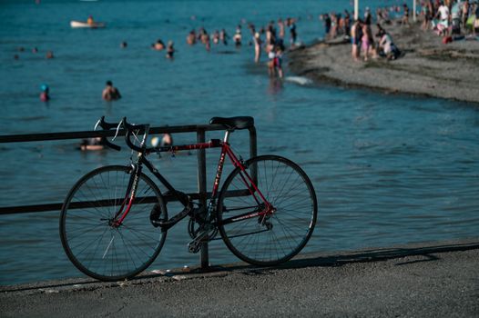 Photo: Caio / Pexels
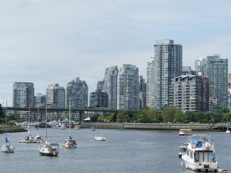 Photo: The Six / Pexels
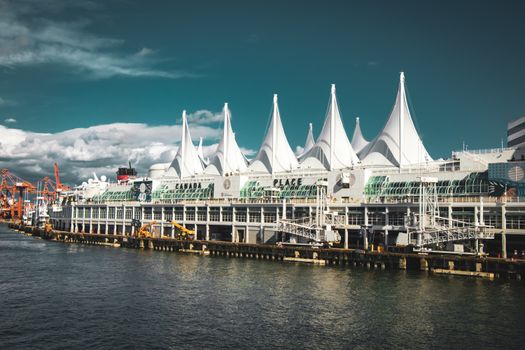 Photo: Tejvinder Singh / Pexels